

Satellite Crop Monitoring India 2026 – Save 30% Input Cost
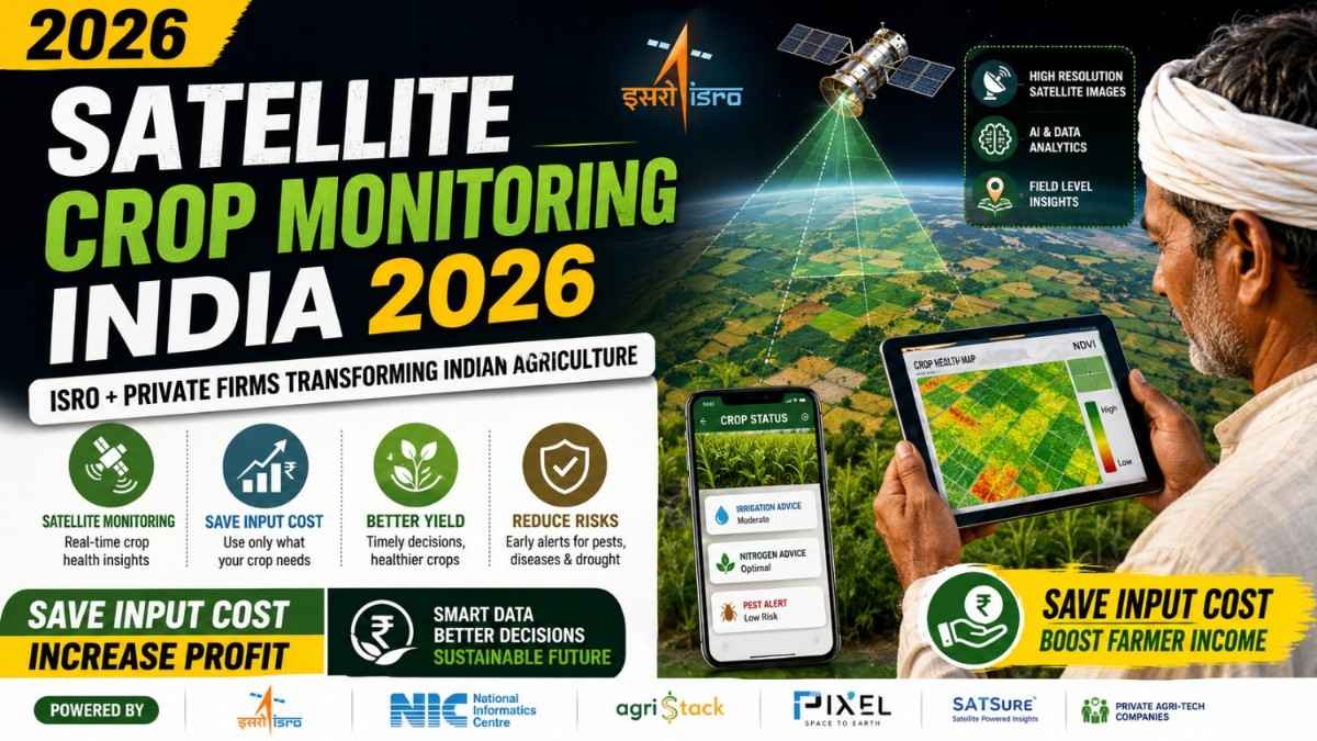
Satellite crop monitoring in India has moved from a government research programme to a field-proven, commercially available technology in 2026 — and it is directly helping farmers save 25–40% on fertilisers, water, and pesticides every season. With ISRO’s landmark FASAL and Krishi-DSS programmes, the historic launch of the joint NASA-ISRO NISAR satellite on 30 July 2025, and private agritech firms like Farmonaut and CropIn deploying AI-powered satellite advisory tools accessible from any Android smartphone, Indian agriculture is entering its most data-rich era ever. For a typical 3-acre Indian farmer spending Rs.50,000 per season on inputs, satellite-guided precision farming can translate into savings of Rs.12,500–Rs.20,000 every single crop cycle — with zero compromise on yield. This complete 2026 guide covers everything: how satellite crop monitoring works, ISRO’s key programmes, the top private platforms, how it saves input costs with real numbers, career opportunities in remote sensing for agriculture, eligibility, salary, and how to access these technologies as a farmer today.

📋 Table of Contents
- How Satellite Crop Monitoring Works – The Science Explained Simply
- ISRO’s 5 Key Satellite Agriculture Programmes in India 2026
- NISAR Satellite – India’s Most Powerful Agricultural Monitoring Tool (Launched July 2025)
- Krishi-DSS – India’s First Geospatial Agriculture Decision Platform
- Top Private Firms Offering Satellite Crop Monitoring in India
- How Satellite Monitoring Saves 30% Input Cost – Real Numbers for Indian Farmers
- Career & Salary in Satellite Agriculture & Remote Sensing India 2026
- Eligibility & How to Access Satellite Crop Monitoring as a Farmer
- Who Should Pursue Satellite Agriculture Careers in India?
- ISRO Government Platforms vs Private Agritech Satellite Tools – Comparison
- High-Value Remote Sensing & Precision Farming Terms You Must Know
- Frequently Asked Questions – Satellite Crop Monitoring India 2026
📌 Key Facts at a Glance – Satellite Crop Monitoring India 2026

| Latest Satellite Launch | NISAR (NASA-ISRO) — 30 July 2025, Sriharikota |
| NISAR Orbit Altitude | 740 km, sun-synchronous; images every 12 days |
| Key Govt. Platform | Krishi-DSS (geospatial agriculture DSS, launched 2023) |
| Crops Monitored (FASAL) | 11 crops: rice, wheat, tur, mustard, jowar, cotton, jute, sugarcane, soybean, lentil, gram |
| Input Cost Saving Potential | 25–40% reduction in fertiliser, water, pesticide costs |
| Top Private Platform | Farmonaut (plans from Rs.200/month), CropIn, SatSure |
| Precision Level (NISAR) | 10-metre plot resolution; 242-km swath width per pass |
| Career Entry Salary | Rs.37,000–Rs.54,000/month (ICAR/ISRO JRF to RA level) |
| Senior Scientist Salary | Rs.67,700–Rs.2,08,700/month (ISRO/ICAR Scientist grade) |
| India Agritech Market Size | Rs.8,000+ crore (2025); projected Rs.20,000+ crore by 2034 |
How Satellite Crop Monitoring Works – The Science Explained Simply
Satellite crop monitoring in India works by capturing images of agricultural fields from space using sensors that detect light wavelengths invisible to the human eye — particularly near-infrared and shortwave infrared light. Healthy green crops reflect near-infrared light very strongly, while stressed or diseased crops reflect it weakly. Satellites measure this contrast, generate numerical indices like NDVI (Normalised Difference Vegetation Index), and translate the raw numbers into colour-coded maps that show exactly which parts of a field are thriving and which parts are stressed.
Modern satellite systems used for Indian agriculture combine three types of sensing technology to give a complete picture of field conditions:
- 🌈 Multispectral imaging: Captures visible + near-infrared + shortwave infrared light from crop canopies. Used to calculate NDVI, NDWI (water stress index), and chlorophyll content. Platforms: Sentinel-2 (ESA, free), Resourcesat-2A (ISRO), Landsat-9 (NASA/USGS, free).
- 📡 Synthetic Aperture Radar (SAR): Uses microwave radar pulses that penetrate cloud cover and work 24 hours a day regardless of weather. Critical for India’s monsoon season when optical satellites are blocked by clouds for months. The new NISAR satellite uses dual L-band and S-band SAR — the most advanced SAR ever deployed for agriculture.
- 🌡️ Thermal infrared: Measures surface temperature of crop canopies. Stressed crops with reduced water use have higher canopy temperatures — detectable from space. Used for precision irrigation scheduling and early drought stress detection.
The satellite data is processed through AI algorithms and fed into platforms like ISRO’s Krishi-DSS or private apps like Farmonaut, which translate complex satellite imagery into simple farm-level recommendations: irrigate this zone, apply fertiliser here, disease detected in this plot, spray in 48 hours. The entire process — from satellite capture to farmer advisory — now takes less than 48 hours in the most advanced platforms.
ISRO’s 5 Key Satellite Agriculture Programmes in India 2026
Since its establishment in 1969, ISRO (Indian Space Research Organisation) has built one of the world’s most comprehensive satellite-based agricultural monitoring systems. The Ministry of Agriculture and Farmers Welfare collaborates with ISRO through several flagship programmes, each addressing a specific aspect of agricultural monitoring and decision support.
1. FASAL – Forecasting Agricultural Output Using Space Technology
FASAL (Forecasting Agricultural Output using Space, Agro-meteorology and Land-based Observations) is ISRO’s longest-running and most impactful satellite agriculture programme. It integrates satellite remote sensing data with agro-meteorological observations and field-based surveys to generate pre-harvest crop production forecasts with high accuracy — months before harvest.
- 🌾 Crops covered: 11 major crops — rice, wheat, tur, rapeseed and mustard, rabi jowar, cotton, jute, sugarcane, soybean, lentil, and gram. Research is expanding to cover pulses and oilseeds further.
- 📊 Output: National and state-level crop area and production estimates, released well before harvest — enabling government procurement planning, price stabilisation, and export-import decisions.
- 🛰️ Satellites used: Resourcesat-2 (AWiFS and LISS-III sensors), Sentinel-2, and RISAT (Radar Imaging Satellite) for kharif crops during cloudy monsoon season.
- 🌐 Operator: Mahalanobis National Crop Forecast Centre (MNCFC), established 2012, under the Department of Agriculture and Farmers Welfare.
2. NADAMS – National Agricultural Drought Assessment and Monitoring System
NADAMS uses satellite-derived vegetation indices and thermal data to monitor agricultural drought conditions in near real-time across all 650+ districts of India. It is one of the most critical systems for India’s food security management, enabling early government intervention before drought causes irreversible crop loss.
- 🌵 Drought monitoring frequency: Fortnightly updates during kharif season (June–October), monthly during rabi season (November–April)
- 📈 Parameters tracked: Rainfall deficit, soil moisture anomaly, vegetation stress index (NDVI anomaly vs. long-term average), reservoir storage levels
- 📋 User: Ministry of Agriculture, State Government Revenue Departments, NDRF (National Disaster Response Force), and insurance companies for PMFBY drought claims
3. CHAMAN – Coordinated Horticulture Assessment and Management
CHAMAN (Coordinated programme on Horticulture Assessment and Management using geoiNformatics) is ISRO’s satellite programme specifically targeting India’s vast horticulture sector — covering fruits, vegetables, spices, and plantation crops that together account for over Rs.3,00,000 crore in farm income annually.
- 🍊 Crops mapped: Mango, banana, citrus, grapes, guava, potato, onion, tomato, and major spices across all horticulture-intensive states
- 🗺️ Output: Area maps, crop health assessments, yield estimates, and site suitability analysis for horticulture expansion in currently under-utilised areas
- 📱 Field data: CHAMAN integrates a mobile app for geotagged field photo collection by extension workers, linking ground truth to satellite estimates
4. NPSTA – National Programme on Space Technology for Agriculture
NPSTA is the umbrella programme under which all of ISRO’s agricultural remote sensing activities are consolidated. It coordinates FASAL, NADAMS, CHAMAN, and newer initiatives under a single national framework, ensuring data interoperability and avoiding duplication across 14 ISRO centres, ICAR institutes, and State Agriculture Departments.
5. YESTECH – Yield Estimation System Using Space Technology
YESTECH is ISRO’s dedicated satellite-based yield estimation system, integrated with the PMFBY crop insurance programme to replace or significantly reduce manual Crop Cutting Experiments. By using high-resolution satellite imagery to estimate crop biomass and yield at the village level, YESTECH enables faster, more objective insurance claim processing — directly benefiting farmers waiting for compensation after crop losses.
NISAR Satellite – India’s Most Powerful Agricultural Monitoring Tool
The launch of the NISAR (NASA-ISRO Synthetic Aperture Radar) satellite on 30 July 2025 from Satish Dhawan Space Centre, Sriharikota, represents the single most significant leap forward in India’s satellite-based agricultural monitoring capability. Described by scientists as “the most sophisticated radar ever built” for Earth observation, NISAR is a joint Rs.9,000+ crore ($1.5 billion) mission by NASA and ISRO that will fundamentally transform how India monitors its 140 million farming households’ crops.
- 📡 Dual-frequency SAR technology: NISAR uses both L-band and S-band synthetic aperture radar simultaneously — the first satellite in history to do so. L-band radar penetrates crop canopies to measure stalk and soil moisture; S-band measures canopy structure and leaf area. Together they give an unprecedented 3D picture of every farm field.
- 🌧️ All-weather, 24/7 imaging: Unlike optical satellites (blocked by monsoon clouds for 4–6 months in India), NISAR’s radar sees through clouds, rain, and darkness. This is transformational for India’s kharif crop monitoring — historically the most data-poor period.
- 🗺️ Precision and coverage: NISAR images nearly all of Earth’s land surface every 12 days, resolving farm plots down to 10 metres wide across a 242-kilometre swath per pass. This means every Indian smallholder’s field — even a 0.5-acre plot — can be individually monitored.
- 💧 Soil moisture mapping: NISAR’s radar can detect soil moisture changes of less than 1 centimetre in surface deformation — enabling precise, week-by-week irrigation scheduling for large-scale deployment across India’s 68% rainfed agricultural area.
- 📊 Data volume: NISAR produces approximately 80 terabytes of data products per day. ISRO’s ground stations and data processing centres in India will receive and process India-specific data, making it available for agricultural management, disaster response, and crop insurance systems.
- 🌾 Crop calendar tracking: NISAR can monitor crop development from sowing to harvest on a continuous basis — detecting sowing dates, tillering stages, heading, flowering, and maturity across all crop types. This enables dynamic, real-time crop yield forecasting at district level across all of India.
Krishi-DSS – India’s First Geospatial Agriculture Decision Platform
Krishi-DSS (Krishi Decision Support System) is a first-of-its-kind geospatial platform for Indian agriculture, jointly developed by the Department of Agriculture and Farmers Welfare (DACFW) and ISRO, and formally unveiled in 2023. It is modelled on the PM GatiShakti national master planning framework — applying the same philosophy of integrating multiple data layers into a single, accessible platform, but specifically for agriculture.
Krishi-DSS brings together 7 critical data streams into a single interface accessible online by state government officers, district agricultural officials, insurance assessors, and increasingly by agritech companies building farmer-facing advisory apps on top of it:
- 🛰️ Satellite imagery layer: Real-time and time-series NDVI, NDWI, and land surface temperature maps from Resourcesat, Sentinel-2, and now NISAR data
- 🌦️ Weather data layer: IMD gridded weather observations and forecast data at block level — rainfall, temperature, humidity, wind speed
- 💧 Water resources layer: Reservoir storage levels from CWC, groundwater depth data from CGWB, and irrigation canal availability
- 🌱 Soil health layer: Soil Health Card data from across India mapped geospatially — pH, nitrogen, phosphorus, potassium, and micronutrient maps by district
- 🗺️ Crop mapping layer: Parcel-level crop type maps showing what is currently being grown in each field across India, updated seasonally
- 📋 Farmer database layer: Integration with Agri Stack — the national farmer registry — linking individual farmer land records to satellite field data
- 🌿 Advisory and alert layer: Pest outbreak early warnings, extreme weather event alerts, and crop-specific advisory notifications generated from all above data streams
Krishi-DSS is also integrated with the PMFBY crop insurance system, using satellite-verified crop area and health data to streamline claim processing. Officials can now assess crop damage across hundreds of villages within days of a flood or drought event — compared to the months it previously took with manual Crop Cutting Experiments.
Top Private Firms Offering Satellite Crop Monitoring in India 2026
Alongside ISRO’s government programmes, a growing ecosystem of private agritech companies is making satellite crop monitoring in India commercially accessible to farmers at every scale — from 1-acre smallholders to 10,000-acre agribusinesses. Here are the leading players in 2026:
Farmonaut – Affordable Satellite Monitoring for Every Indian Farmer
Farmonaut is an Indian agritech company that has built one of the most accessible satellite-based farm management platforms for Indian conditions — with plans starting at Rs.200 per month, making satellite advisory genuinely affordable for smallholder farmers. Farmonaut received grants from MEITY Samridh and NIDHI SSS (government startup support programmes) and is targeting 100+ enterprise clients by 2026.
- 🛰️ NDVI monitoring: Weekly multispectral satellite imagery showing crop health variations within each field — helping farmers spot stressed zones before they become crop failures
- 💧 Soil moisture tracking: Satellite-derived soil moisture maps enabling precision irrigation — farmers irrigate only when and where needed
- 🔗 Blockchain traceability: Farm-to-fork traceability for export-quality produce, enabling Indian farmers to access premium international buyers who demand certification
- 🤖 JEEVN AI system: AI-powered crop advisory integrated with satellite data for personalised field-level recommendations
- 💰 Pricing: SaaS subscriptions from Rs.200/month for basic monitoring; enterprise plans for agribusinesses and government agencies
CropIn – AI-Powered Satellite Farm Intelligence (Google Gemini Partnership)
CropIn (Bengaluru) is one of India’s most globally recognised agritech platforms, providing AI-powered farm monitoring using satellite imagery to agribusinesses, FPOs (Farmer Producer Organisations), and government agencies across India and 52+ other countries. In 2024, CropIn partnered with Google Gemini to launch a real-time GenAI-powered agricultural intelligence platform.
- 📊 Yield prediction: AI models trained on satellite + weather + soil data predict crop yields 4–6 weeks before harvest with up to 90% accuracy
- 🌾 Crop area mapping: Parcel-level crop type identification across hundreds of thousands of farm plots using machine learning and satellite imagery
- ⚠️ Early warning systems: Predicts weather pattern disruptions and early signs of pest infestations from satellite spectral anomalies
- 🌍 Scale: Operating across 52+ countries, monitoring millions of acres of farmland with satellite-based intelligence tools
SatSure – Satellite Analytics for Crop Insurance and Agri-Finance
SatSure (Bengaluru) is a deep-tech satellite analytics company focused on the intersection of remote sensing and financial services in agriculture. Its platform is widely used by banks, insurance companies, and NBFCs to verify crop area, assess crop health, and evaluate loan and insurance risk for Indian farmers — enabling faster, fairer credit and insurance decisions.
Salam Kisan – Multi-Stack Precision Farming with Satellite Intelligence
Salam Kisan is a comprehensive precision farming platform that integrates satellite crop monitoring with an AI-enabled crop calendar, customised fertiliser dosage recommendations, drone rental for spraying, farm mapping, and a farmer community network. Its government convergence module links satellite advisories directly with scheme benefits available to each registered farmer.
How Satellite Monitoring Saves 30% Input Cost – Real Numbers for Indian Farmers
The headline claim — that satellite crop monitoring saves 30% of input costs — is not marketing language; it is backed by field trials and deployment data from India and globally. Here is a detailed breakdown of exactly where and how the savings occur for a typical Indian farmer in 2026:
| Input Category | Conventional Farming Cost (3 acres/season) | With Satellite Monitoring | Saving % | Saving Amount (Rs.) | Mechanism |
|---|---|---|---|---|---|
| Fertiliser (NPK) | Rs.18,000 | Rs.12,600 | 30% | Rs.5,400 | Soil map + NDVI shows only deficient zones; apply precisely, not blanket |
| Irrigation water/power | Rs.8,000 | Rs.5,600 | 30% | Rs.2,400 | Satellite soil moisture index triggers irrigation only when crop needs it |
| Pesticide/insecticide | Rs.10,000 | Rs.6,500 | 35% | Rs.3,500 | Early AI-satellite pest detection treats in early stage — far cheaper than curative sprays |
| Crop loss from disease | Rs.12,000 (avg. loss) | Rs.7,200 | 40% | Rs.4,800 | Spectral stress detection 7–14 days before visible symptoms; early intervention saves crop |
| Labour (spraying, irrigation) | Rs.6,000 | Rs.4,200 | 30% | Rs.1,800 | Targeted operations reduce number of passes; drone spraying 8–10x faster than manual |
| Total Inputs (3 acres) | Rs.54,000 | Rs.36,100 | 33% | Rs.17,900 saved | Combined precision effect across all input categories |
Beyond direct input cost savings, satellite crop monitoring generates additional income benefits that compound the total farm profitability impact. Precision yield prediction enables farmers to plan post-harvest storage and sell at peak price rather than distress-selling at harvest — a benefit worth Rs.5,000–Rs.15,000 per season for commodity crops like wheat, rice, and soybean. Satellite-verified farm data also unlocks faster access to institutional credit and PMFBY insurance payouts, eliminating months of waiting that small farmers cannot afford.
💡 Pro Tip for Farmers: You do not need to buy expensive equipment to access satellite crop monitoring. The government’s Krishi-DSS platform is free and accessible to state and district agriculture officers — so your nearest Krishi Vigyan Kendra (KVK) or Block Agriculture Officer can pull up a satellite health map of your field on request. For personal access, Farmonaut offers plans from Rs.200/month — less than the cost of a single fertiliser bag — and delivers weekly NDVI crop health maps directly to your smartphone. Register at farmonaut.com for a free trial. For ISRO’s free satellite data, visit the Bhoonidhi Portal operated by ISRO’s National Remote Sensing Centre — it provides free access to extensive remote sensing data archives for research and commercial use.
Career & Salary in Satellite Agriculture & Remote Sensing India 2026
The rapid expansion of satellite crop monitoring in India is creating significant demand for trained professionals in remote sensing, GIS, AI, and agricultural science. Career opportunities exist across government agencies (ISRO, ICAR, MNCFC), private agritech firms (Farmonaut, CropIn, SatSure), and international organisations (FAO, World Bank agriculture projects). Here is the complete salary landscape for 2026:
| Position | Monthly Salary/Stipend | Annual Earning | Employer Type | Qualification Needed |
|---|---|---|---|---|
| Junior Research Fellow (JRF) — Remote Sensing | Rs.37,000 + HRA | Rs.4,44,000+ HRA | ICAR, ISRO, SAC | M.Sc. Remote Sensing / Agriculture + NET/GATE |
| Senior Research Fellow (SRF) — Geoinformatics | Rs.42,000 + HRA | Rs.5,04,000+ HRA | ICAR, ISRO, NRSC | M.Sc. + 2 yrs research experience |
| Research Associate — Satellite Agriculture | Rs.54,000 + HRA | Rs.6,48,000+ HRA | ICAR-IARI, MNCFC | Ph.D. Plant Sciences / Remote Sensing |
| GIS Analyst — Private Agritech | Rs.35,000–Rs.65,000 | Rs.4,20,000–Rs.7,80,000 | Farmonaut, CropIn, SatSure | M.Sc. Remote Sensing / B.Tech GIS + skills |
| Data Scientist — Agritech | Rs.60,000–Rs.1,20,000 | Rs.7,20,000–Rs.14,40,000 | CropIn, SatSure, Salam Kisan | M.Tech / M.Sc. CS / AI + agri domain knowledge |
| Scientist B (ISRO/ICAR ARS) | Rs.67,700–Rs.1,08,000 | Rs.8,12,400+ | ISRO-SAC, NRSC, ICAR | Ph.D. + ASRB/ISRO Scientist exam |
| Senior Scientist / Project Scientist (ISRO) | Rs.1,08,000–Rs.2,08,700 | Rs.12,96,000–Rs.25,04,400 | ISRO (Scientist/Engineer SD to SF grade) | Ph.D. + years of research output |
Eligibility & How to Access Satellite Crop Monitoring as a Farmer
Accessing satellite crop monitoring benefits as an Indian farmer in 2026 does not require any technical expertise. Here is the complete eligibility and access guide:
- 🌾 Any registered farmer in India with a PM-KISAN registration or a land record (Khatian/RoR) in any state is eligible to benefit from satellite monitoring through their district agriculture office, KVK, or directly through apps like Farmonaut, Salam Kisan, and CropIn’s FPO programmes.
- 📱 Smartphone access (Android): A smartphone with Android 8.0 or higher and mobile data is sufficient to access Farmonaut, Salam Kisan, and other satellite advisory apps directly.
- 🏢 Through FPO (Farmer Producer Organisation): Farmers who are members of an FPO can access enterprise-grade satellite monitoring (CropIn, SatSure, Farmonaut enterprise) through their FPO’s subscription at a shared cost of Rs.50–Rs.100 per member per month.
- 🏛️ Through KVK or BAO: Every Krishi Vigyan Kendra (731 across India) and Block Agriculture Office can access Krishi-DSS satellite maps. Visit your KVK and request a crop health assessment for your village cluster — this is free under government programmes.
- 📋 PMFBY satellite benefits: All farmers enrolled in PMFBY crop insurance automatically benefit from ISRO’s YESTECH and FASAL satellite data used in yield estimation and damage assessment — no additional action needed.
| Category | Age Limit (Research Jobs) | Age Relaxation | Application Fee |
|---|---|---|---|
| General / UR | Up to 35 years (SRF/RA) | None | Rs. 0 (most ICAR/ISRO project posts) |
| OBC (Non-Creamy Layer) | Up to 38 years | 3 years | Rs. 0 |
| SC / ST | Up to 40 years | 5 years | Rs. 0 |
| PwBD (Divyangjan) | Up to 40–45 years | 10–15 years | Rs. 0 |
| ISRO Scientist Exam (all) | Up to 35 years | 5 years SC/ST; 3 years OBC | Rs. 250–Rs. 500 (varies) |
Who Should Pursue Satellite Agriculture Careers in India?
A career in satellite crop monitoring and remote sensing for agriculture is one of the fastest-growing and best-paid government and private sector pathways for science graduates in India. Here are 8 specific candidate profiles who should strongly consider this field:
- 🛰️ Geography and remote sensing graduates (M.Sc./M.Tech.): Candidates with postgraduate degrees from institutions like IIT Bombay, IIRS Dehradun, Anna University, or NRSC who specialise in GIS and remote sensing are the most direct fit for JRF and scientist positions at ISRO-SAC, NRSC, and ICAR-IARI’s Remote Sensing Division.
- 🌾 Agriculture graduates with interest in technology (B.Sc./M.Sc. Agri): Graduates in agronomy, plant breeding, or agricultural science who want to combine their crop knowledge with satellite tools can build dual expertise as agro-remote sensing specialists — one of the most in-demand profiles at private firms like CropIn, Farmonaut, and SatSure in 2026.
- 💻 Computer science graduates with AI/ML interest: Data scientists with programming skills in Python, Google Earth Engine, and machine learning who want to work on agricultural impact problems. Private agritech firms offer Rs.60,000–Rs.1,20,000/month for this profile.
- 📡 Electronics/ECE engineers: Candidates with satellite communication, signal processing, or microwave engineering background are valuable for ISRO’s SAR data processing teams and the NISAR data pipeline — among the most technically challenging and well-compensated government science roles in India.
- 👩🔬 Women researchers in geospatial sciences: ISRO and ICAR both actively encourage women applicants with age relaxation benefits. Government remote sensing institutions provide structured, secure work environments. Several women scientists lead FASAL and CHAMAN research teams at MNCFC.
- 🌱 SC/ST graduates from agricultural universities: Reserved category candidates get 5-year age relaxation and zero application fees for most ICAR and ISRO project positions. Satellite agriculture combines science, technology, and social impact — a highly aspirational career for rural science graduates.
- 📊 MBA graduates with agribusiness interest: Business development, product management, and customer success roles at CropIn, Farmonaut, and SatSure require candidates who understand both agricultural economics and satellite technology — a rare combination that commands premium salaries in the private agritech sector.
- 🌐 UPSC/IFS aspirants with science background: Candidates preparing for competitive government exams who want a well-paid, intellectually stimulating bridge year. ICAR and ISRO JRF/SRF positions in satellite agriculture offer Rs.37,000–Rs.42,000/month, cutting-edge research experience, and strong UPSC/IFS interview material simultaneously.
ISRO Government Platforms vs Private Agritech Satellite Tools – Comparison
Understanding the difference between ISRO’s government satellite platforms and private agritech satellite tools helps farmers, policymakers, and career-seekers choose the right path for their specific needs.
| Parameter | ISRO Govt. Platforms (FASAL, Krishi-DSS, NADAMS) | Private Agritech Satellite Firms (Farmonaut, CropIn, SatSure) |
|---|---|---|
| Primary User | Government agencies, state agriculture depts., insurance | Individual farmers, FPOs, agribusinesses, banks |
| Access Cost for Farmer | Free (via KVK/BAO) — taxpayer funded | Rs.200–Rs.500/month (Farmonaut); enterprise pricing for larger farms |
| Satellite Data Source | ISRO’s own Resourcesat, RISAT + NISAR (from 2025) | Sentinel-2 (ESA), Landsat, Planet Labs + ISRO open data |
| Frequency of Updates | Fortnightly (NADAMS), seasonal (FASAL, CHAMAN) | Weekly to daily (private platforms use multiple satellites) |
| Field-Level Resolution | 25–56 metres (AWiFS, Sentinel-2); 10m with NISAR | 10 metres (Sentinel-2); up to 3m (commercial Planet Labs) |
| Farmer Advisory Delivery | Indirect — through extension officers, KVKs, apps | Direct to farmer smartphone via app (Farmonaut, Salam Kisan) |
| Insurance Integration | Yes — PMFBY, YESTECH deeply integrated | Yes — SatSure, CropIn supply data to insurance companies |
| AI / Personalisation | Limited — primarily aggregate forecasts | Strong — farm-level personalised NDVI, soil moisture, advisory |
| Best For | National/state food security planning, disaster response | Individual farm management, precision input application |
🏆 Expert Verdict: India’s satellite crop monitoring ecosystem in 2026 operates on a powerful two-tier model. ISRO’s government platforms provide the national-scale data infrastructure — feeding crop forecasts, drought monitoring, and insurance systems that protect 11 crore+ farm households. Private agritech firms build on top of this public data foundation to deliver personalised, field-level advisory that directly changes what individual farmers do on Monday morning. The two tiers are complementary, not competitive. For farmers: use both. For students and graduates: the intersection of these two tiers — roles that bridge ISRO satellite data and private-sector farmer-facing applications — represents the most exciting and best-compensated career pathway in Indian agricultural technology in 2026 and beyond.
High-Value Remote Sensing & Precision Farming Terms You Must Know
Whether you are a farmer adopting satellite advisory tools, a student building a career in agricultural remote sensing, or a professional writing about India’s agritech sector, these 10 key terms provide essential conceptual grounding in satellite crop monitoring in India 2026:
- 📊 NDVI (Normalised Difference Vegetation Index): The most widely used satellite-derived index for measuring crop health. Values range from -1 to +1; healthy crops score 0.6–0.9. NDVI is calculated from the ratio of near-infrared minus red reflectance to near-infrared plus red reflectance. Every satellite crop monitoring platform — from ISRO’s Krishi-DSS to Farmonaut — uses NDVI as its primary field health indicator. Learning to read an NDVI map is the single most valuable skill for a precision agriculture career in India.
- 📡 SAR (Synthetic Aperture Radar): A radar-based satellite imaging technology that works through clouds, rain, and at night — critical for India’s monsoon season when optical satellites are blind. The new NISAR satellite’s dual SAR system (L-band + S-band) can penetrate crop canopies to measure stalk biomass, soil moisture, and surface deformation with centimetre-level accuracy — capabilities that will transform kharif crop monitoring across India from 2025–2026 onwards.
- 🌿 Precision Agriculture: A farm management philosophy that uses spatially varied, data-driven inputs rather than uniform blanket applications. In India’s context, precision agriculture using satellite data means applying fertiliser only in the zones of a field that show nutrient deficiency on an NDVI or NDWI map — rather than applying the same rate across the entire field. Studies from India show this approach alone saves 20–30% of total fertiliser expenditure per season.
- 🌍 Earth Observation (EO) Satellites: The category of satellites designed specifically to observe Earth’s surface, atmosphere, and oceans from space. ISRO operates a constellation of EO satellites including Resourcesat-2A (agricultural monitoring), Cartosat-3 (high-resolution mapping), and RISAT-2B (SAR), with NISAR being the most powerful addition. Private firms access EO data from international satellites like ESA’s Sentinel-2 and Planet Labs’ SkySat constellation.
- 💧 NDWI (Normalised Difference Water Index): A satellite-derived index that measures water content in crop canopies and soil. NDWI complements NDVI in irrigation management — while NDVI shows overall crop greenness, NDWI specifically detects when crops are experiencing water stress before visible wilting occurs. Used by Farmonaut and ISRO-SAC platforms to generate precision irrigation scheduling recommendations for water-scarce farming regions in Rajasthan, Maharashtra, and the Deccan plateau.
- 🌾 Crop Cutting Experiment (CCE): India’s traditional method of estimating crop yields by physically harvesting and weighing a sample plot of defined area in thousands of representative fields across each district. CCEs are used for PMFBY crop insurance yield assessment. ISRO’s YESTECH programme is replacing 30–50% of manual CCEs with satellite-derived yield estimates — saving crores in government expenditure while dramatically speeding up insurance claim settlement for farmers.
- 🗺️ Agri Stack (Digital Ecosystem of Agriculture): The Government of India’s national digital framework to create an integrated, interoperable data stack for agriculture — linking farmer land records, soil health data, crop type maps (from satellite), weather data, credit history, and scheme benefit records. Once fully implemented, Agri Stack combined with NISAR satellite data will enable truly personalised, real-time satellite advisory for every individual farmer in India by 2027–2028.
- 🔬 Hyperspectral Remote Sensing: A next-generation satellite imaging technology that captures data across 200+ narrow spectral bands (vs. 10–20 bands for multispectral satellites). Hyperspectral sensors can detect specific crop diseases, nutrient deficiencies (nitrogen, iron, zinc), and even variety-level crop identification from space. ISRO is developing hyperspectral imaging capabilities for its future satellite missions, and this is one of the most research-intensive career areas in Indian remote sensing today.
- 🤖 Google Earth Engine (GEE): A free cloud computing platform provided by Google that allows researchers, agritech companies, and government agencies to process massive volumes of satellite imagery without local computing infrastructure. GEE is the primary tool used by CropIn, SatSure, and academic researchers in India to run large-scale crop mapping and monitoring analyses. Proficiency in GEE is one of the most valuable technical skills for any candidate seeking a career in satellite agriculture in India.
- 🌱 Carbon Farming & Satellite MRV: An emerging high-value application of satellite monitoring where farmers are paid carbon credits for farming practices that sequester soil carbon (zero tillage, cover cropping, agroforestry). Satellite Measurement, Reporting, and Verification (MRV) systems — being piloted by Farmonaut and international climate finance firms — use satellite imagery to verify and quantify the carbon sequestered in Indian farm soils. This is expected to become a Rs.10,000+ crore per year additional income stream for Indian farmers by 2030, with satellite monitoring as the foundation.
Frequently Asked Questions – Satellite Crop Monitoring India 2026
What is satellite crop monitoring in India?
Satellite crop monitoring in India is the use of Earth observation satellites to capture multispectral and radar images of agricultural fields, which are then analysed to assess crop health, estimate yield, detect drought or pest stress, and guide irrigation and fertiliser decisions. ISRO runs programmes like FASAL, NADAMS, and Krishi-DSS, while private firms like Farmonaut, CropIn, and Salam Kisan offer satellite-driven advisory services to Indian farmers. Research in 2025–2026 confirms that satellite-guided precision farming can reduce input costs by 25–40% compared to conventional uniform farming practices.
How does ISRO help Indian farmers through satellites?
ISRO helps Indian farmers through multiple satellite programmes: FASAL forecasts production for 11 major crops including rice, wheat, and cotton using satellite and agro-meteorological data. NADAMS monitors drought in real time across all states. Krishi-DSS (launched 2023) is a geospatial platform integrating satellite imagery, soil health, weather, and water data for agricultural advisory. ISRO also co-launched the NISAR satellite with NASA in July 2025, which maps every Indian farm plot every 12 days using advanced synthetic aperture radar in all weather conditions — including India’s cloud-heavy monsoon season.
What is the NISAR satellite and how does it help Indian agriculture?
NISAR (NASA-ISRO Synthetic Aperture Radar) is a joint satellite launched by India and the USA on 30 July 2025 from Satish Dhawan Space Centre, Sriharikota. It orbits at 740 km altitude and uses dual L-band and S-band radar to scan nearly all of Earth’s land surface every 12 days — in all weather, day and night. For Indian agriculture, NISAR tracks crop growth from sowing to harvest, monitors soil moisture, detects plant health stress, and guides irrigation scheduling. It produces 80 terabytes of data daily and resolves individual farm plots down to 10 metres wide — enabling field-level monitoring for even India’s smallest smallholder farms.
Which private companies offer satellite crop monitoring in India?
Leading private companies offering satellite crop monitoring in India in 2026 include: Farmonaut (Bengaluru) — satellite-based NDVI monitoring, soil moisture tracking, and AI advisory, with plans starting at Rs.200/month; CropIn (Bengaluru) — AI-powered farm monitoring using satellite imagery, partnered with Google Gemini in 2024; Salam Kisan — AI-enabled crop calendar and precision agriculture guidance; Fasal — IoT and satellite micro-climate advisory for horticulture; and SatSure — satellite analytics for crop insurance and agri-finance verification. India’s agtech market is valued at approximately Rs.8,000 crore and growing at 10.59% CAGR through 2034.
How much input cost can farmers save using satellite crop monitoring?
Research and real-world deployments consistently show that satellite crop monitoring and precision farming can reduce input costs by 25–40% annually. Specifically: fertiliser savings of 20–30% through soil-data-driven application; irrigation savings of 25–35% by irrigating only when satellite soil moisture data indicates need; pesticide savings of 30–40% through early AI-detected pest and disease warnings; and crop loss reduction of 15–25% through weather stress alerts. For a typical 3-acre Indian farm spending Rs.54,000 per season on inputs, this translates to savings of Rs.14,000–Rs.20,000 every crop season.
What is NDVI and why is it important for crop monitoring?
NDVI (Normalised Difference Vegetation Index) is a numerical value calculated from satellite multispectral imagery that measures how green and healthy a crop canopy is. NDVI values range from -1 to +1; healthy, dense crops score 0.6 to 0.9, while stressed, sparse, or dead crops score lower. Satellites capture near-infrared and red light reflectance from crop leaves and NDVI is calculated from this ratio. Indian platforms like Farmonaut, CropIn, and the government’s Krishi-DSS use NDVI maps to detect crop stress zones within a field as small as 10 metres — helping farmers target fertiliser or irrigation only where it is actually needed, saving significant input cost.
What are career opportunities in satellite agriculture and remote sensing in India?
Career opportunities in satellite agriculture and remote sensing in India are expanding rapidly in 2026. Government positions at ISRO-SAC, NRSC, and ICAR-IARI offer scientist and research associate roles with salaries from Rs.42,000 to Rs.2,08,700 per month. Private agritech firms like Farmonaut, CropIn, SatSure, and Salam Kisan hire GIS analysts, remote sensing engineers, data scientists, and agronomy advisors with salaries ranging from Rs.35,000 to Rs.1,20,000 per month. Qualifications needed include M.Sc. or M.Tech. in Remote Sensing, Geoinformatics, Agriculture, or Computer Science with GIS experience. Track all new ICAR and ISRO recruitment notifications at Agrijob.in.
How does satellite monitoring help with crop insurance in India?
Satellite monitoring has transformed crop insurance under PMFBY in India by replacing costly and slow manual Crop Cutting Experiments (CCEs) with satellite-derived yield estimates. ISRO’s YESTECH system now provides satellite-based yield estimation that reduces the number of required CCEs by 30–50%. Private firms like SatSure provide satellite-based crop loss verification for insurance companies, enabling claim processing in weeks rather than months. The Krishi-DSS platform integrates insurance data with satellite imagery, allowing field-level damage assessment within days of a natural calamity — so PMFBY payouts reach farmers significantly faster than under the old manual system.
This guide is regularly reviewed and updated for accuracy. Bookmark this page for the latest satellite crop monitoring India developments, ISRO programme updates, and remote sensing career opportunities. For the latest ICAR, ISRO, and agritech recruitment notifications updated daily, visit Agrijob.in — India’s most trusted agriculture jobs and information portal.
Last Updated: May 2026